Carlisle Roman Gateway Project
NAME : Roman Gateway Project DATE : 2010 LOCATION : Carlisle CLIENT : Carlisle City Council PARTNERS: TEP Landscape Architects MANUFACTURING PARTNERS : Stone - Cumbrian Stone. Wood - Eves Joinery Vitreous Enamel - Trico VE
TASK
A collaborative design process with TEP landscape architects to prepare public realm orientation and interpretation solutions for Carlisle City Council that would encourage more people to move between the Historic Quarter of Carlisle City Centre and the Hadrian’s Wall Path running through Bitts park.
DESIGN
Following a process of consultation a design developed that included landscape detailing and sculptural way-finding elements reflecting Carlisle’s history, set along the route of the Roman Gateway on both sides of north Castle Street trail, connecting with the Tullie House Museum entrance and Hadrian’s wall path.
A family of carved Oak posts topped with a carved sandstone block, sandstone way markers and freestanding information boards.
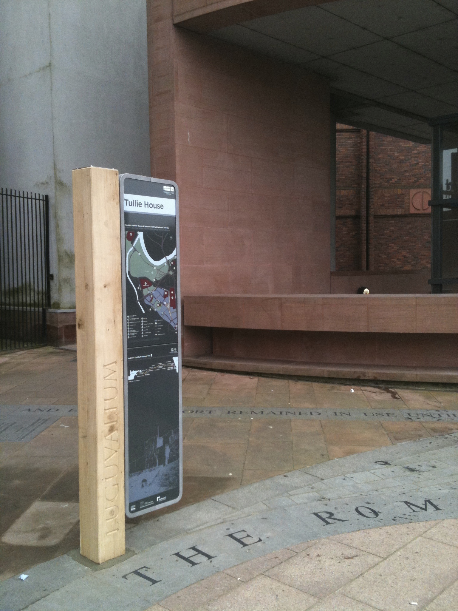
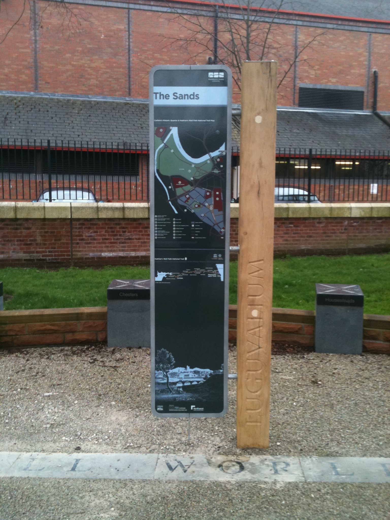
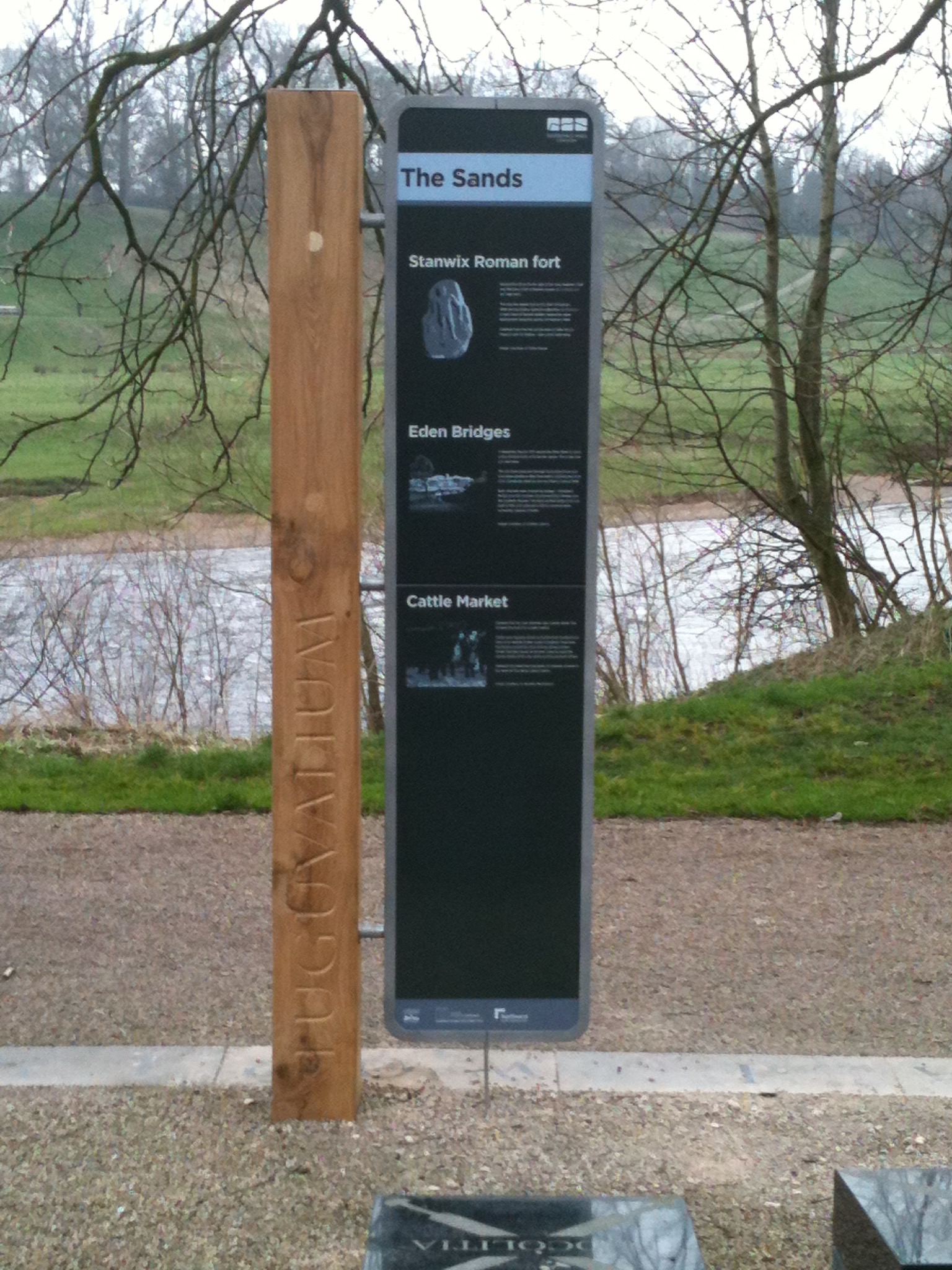
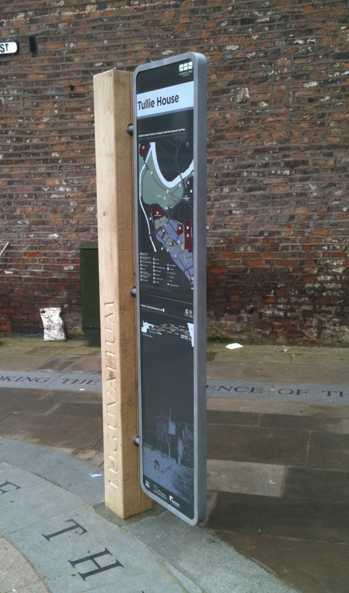
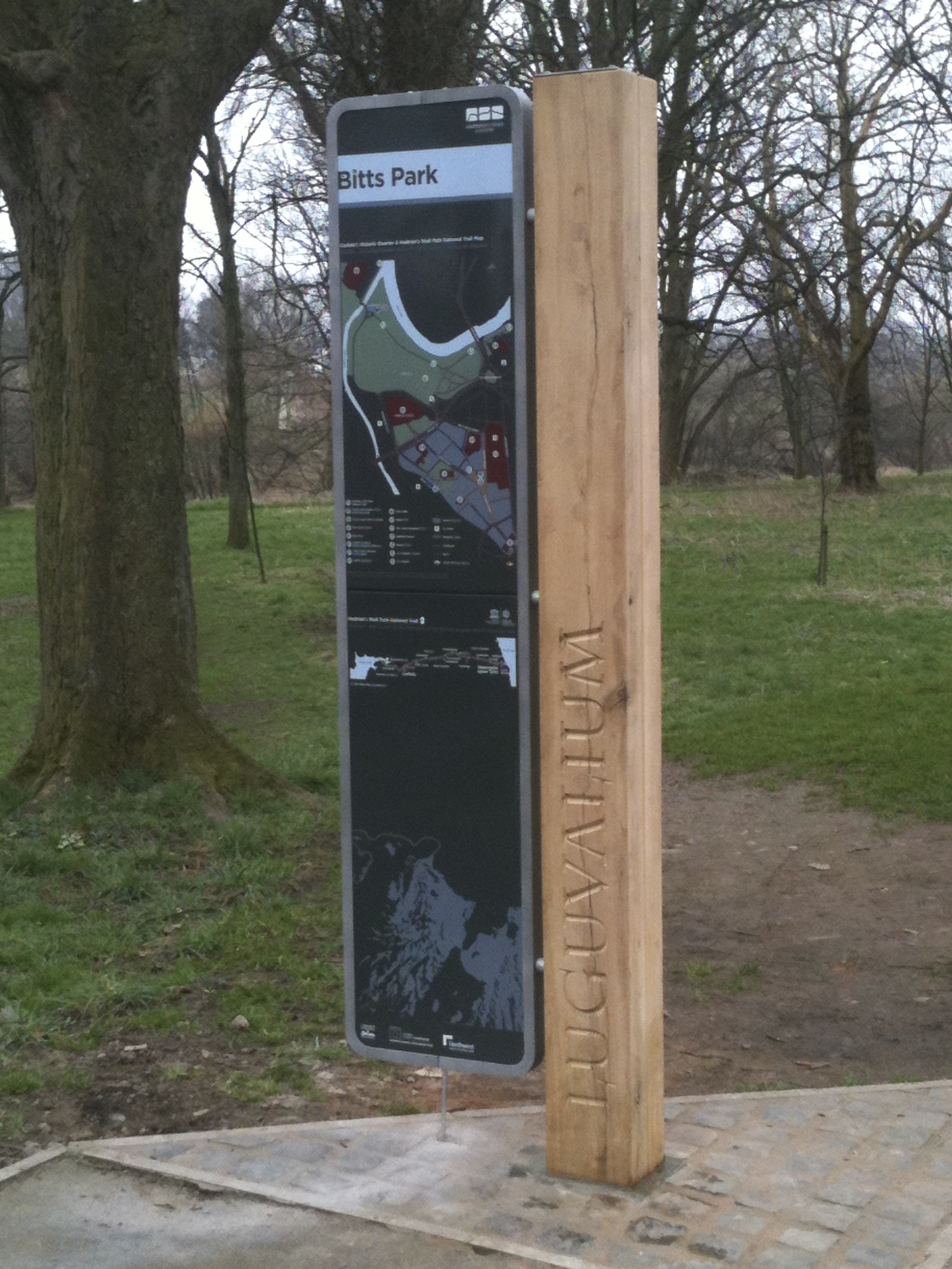
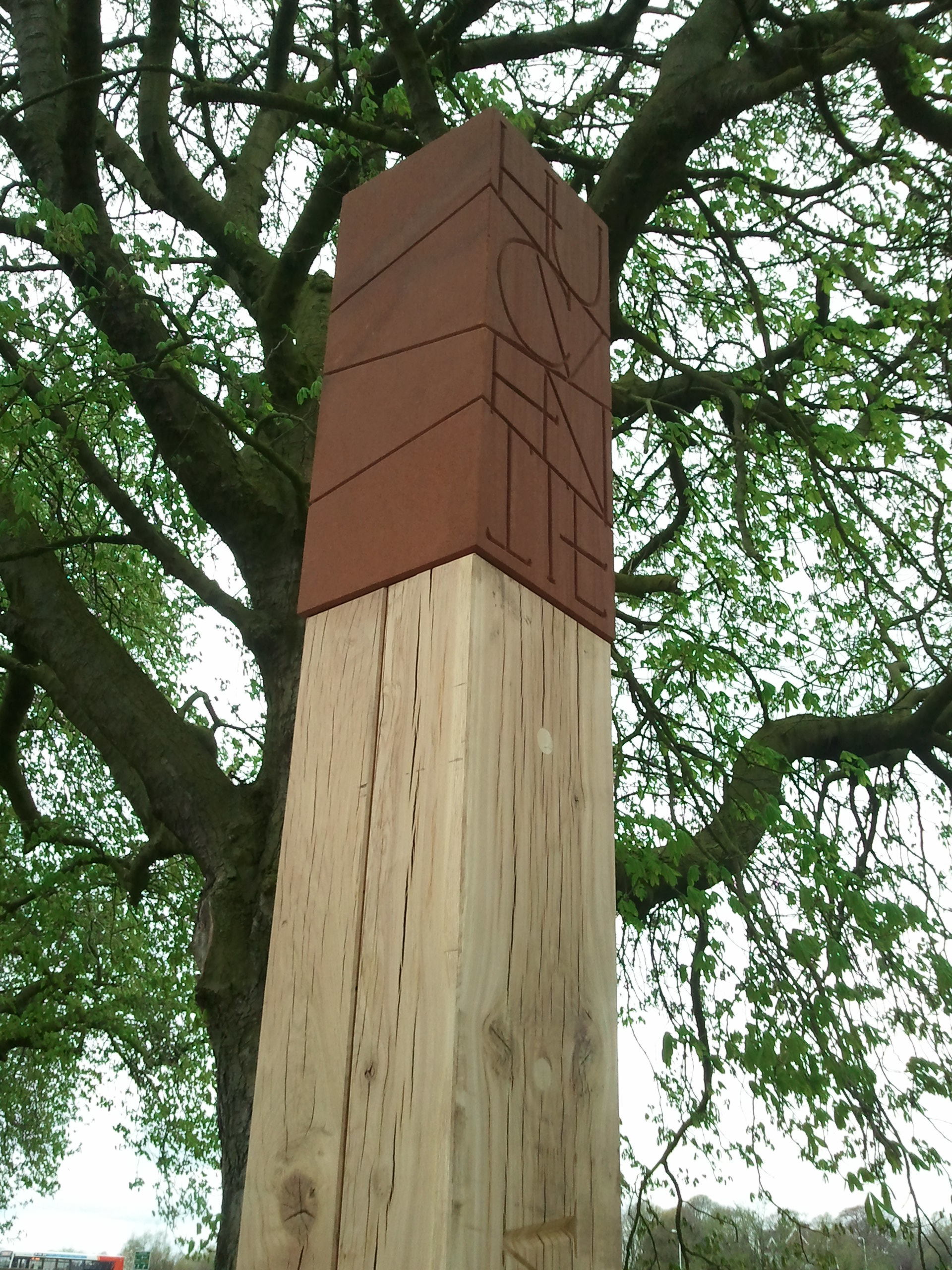
ORIENTATION BEACON & POSTS
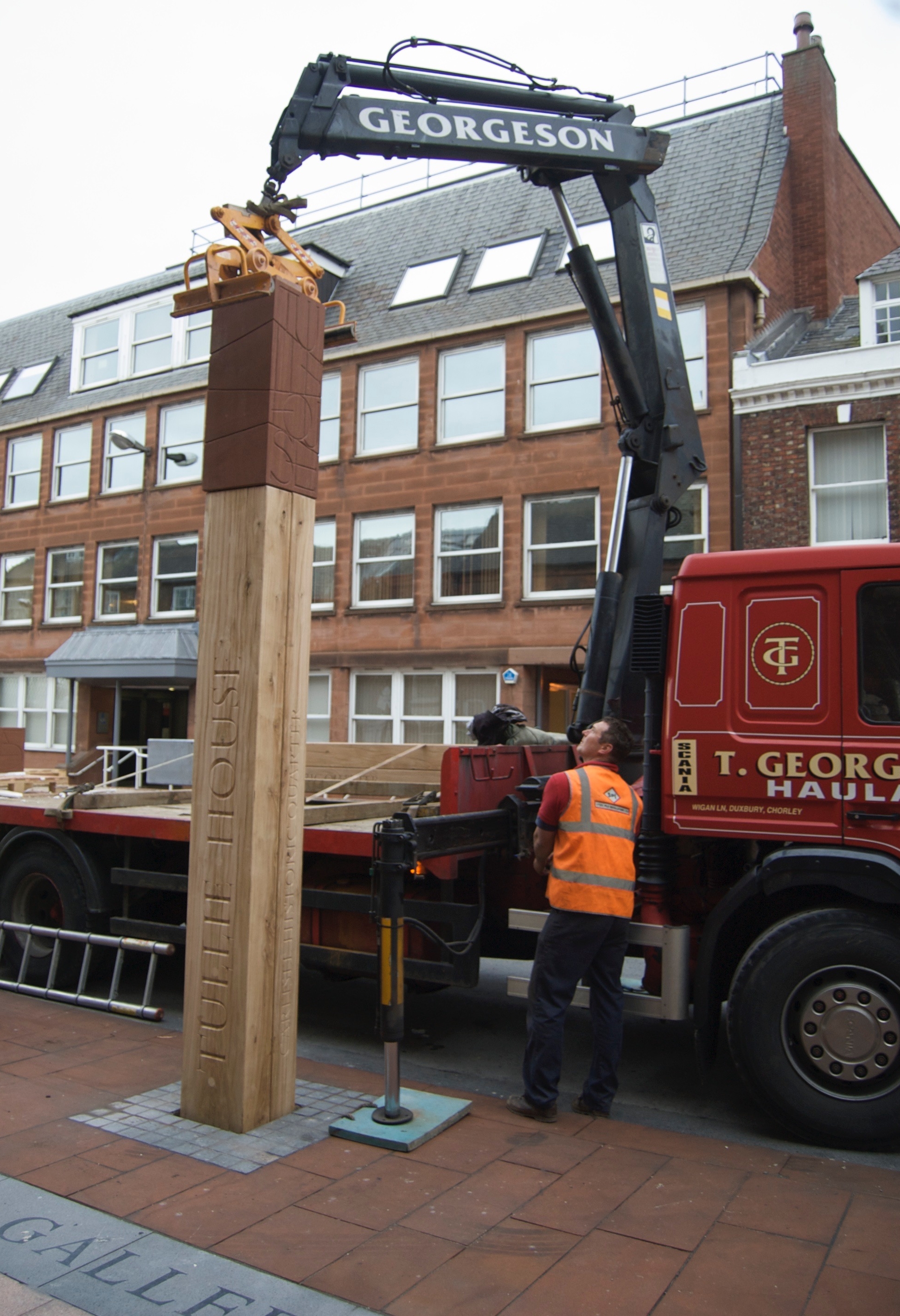
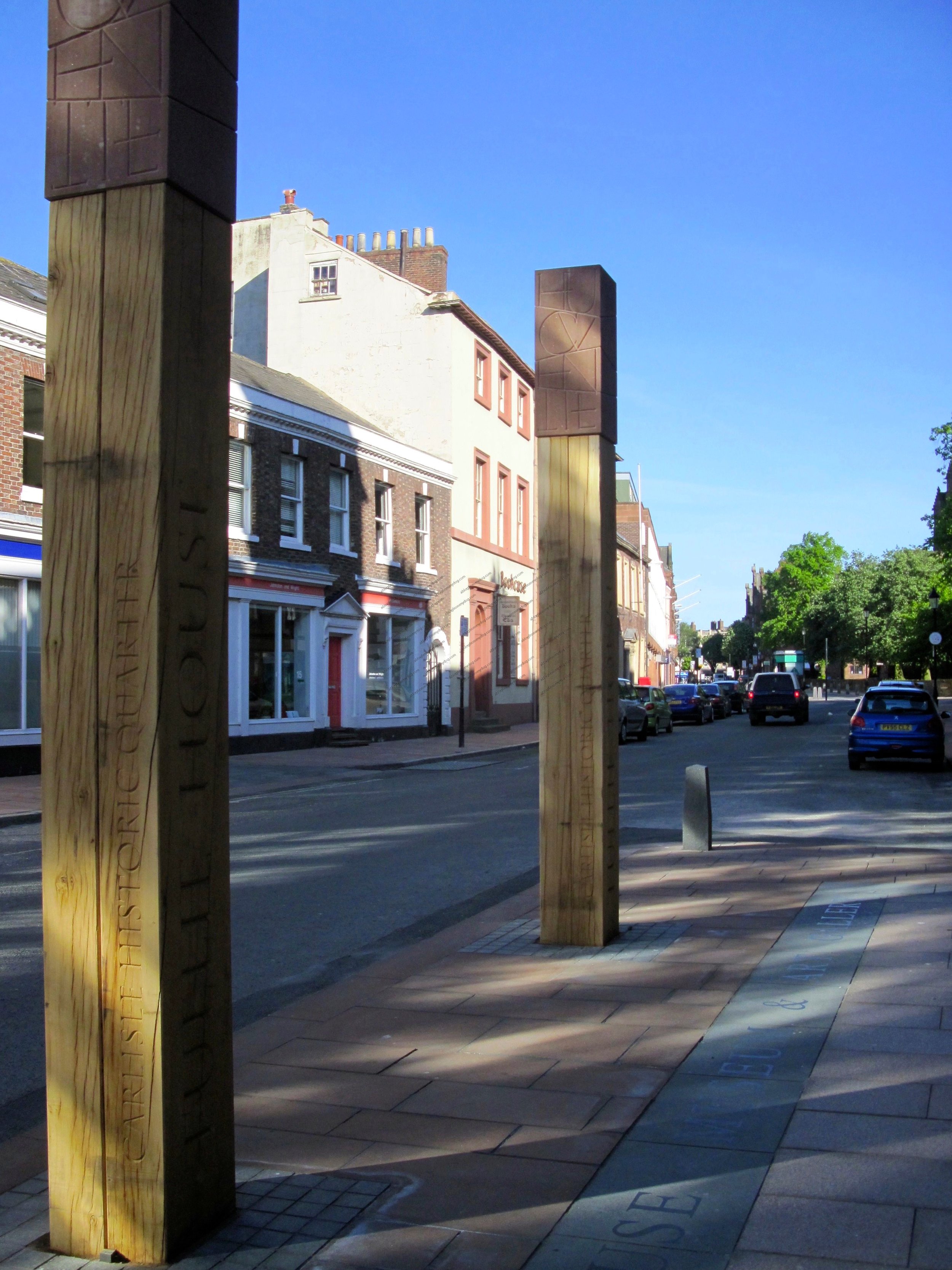
The orientation beacons form bold markers to guide users and create a strong branding to all the spaces. The beacons are 4000mm high x 400mm square. The orientation posts create a link between Bitts Park and the Historic Quarter and are 2890mm x 200mm square.
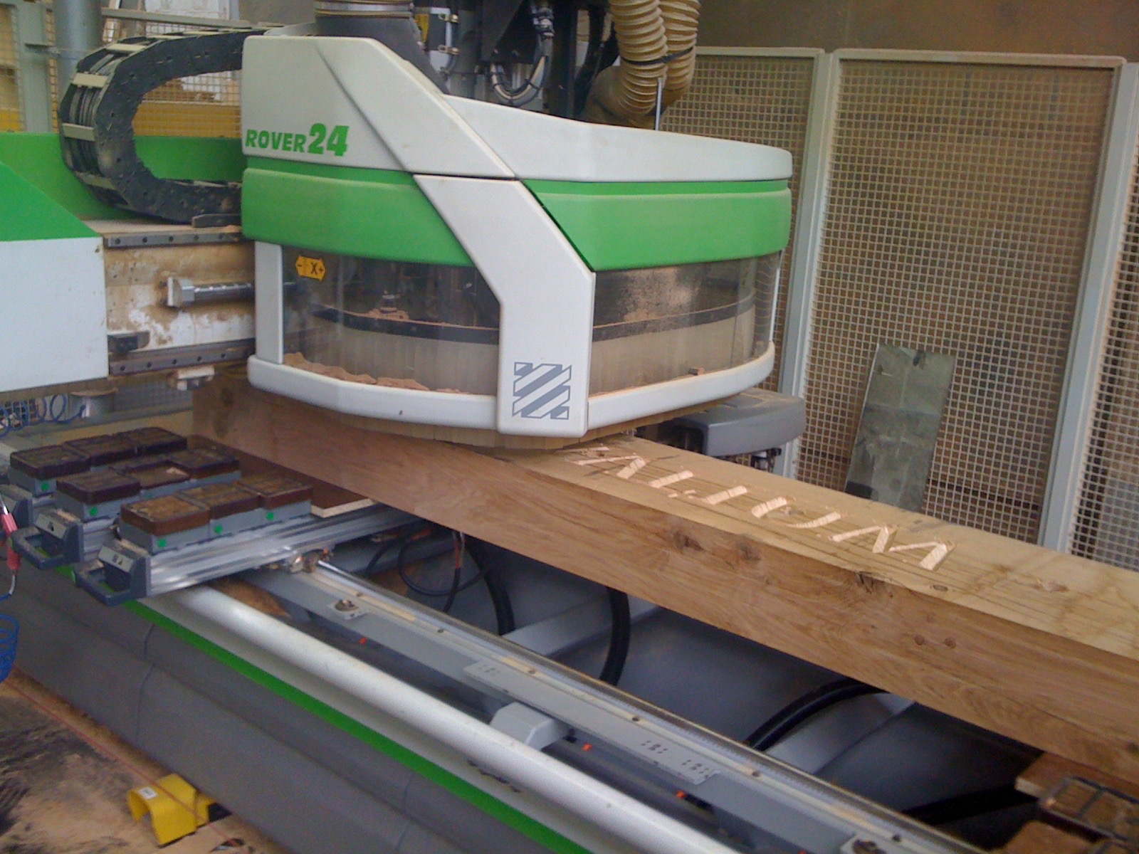
The orientation beacons and posts are constructed from European Oak and red sandstone. The core is formed by a hollow section of steel with timber sections wrapped around a single piece of stone fixed to the top of the core. The base and foundations include a steel foot fixed to an internal hollow section that extends above ground to protect the timber from damage and damp.
The posts and beacons include carved text in the timber on the front facade identifying the location and branding of Carlisle with ‘Lvgvvalivm’ (Roman for Carlisle) incorporated on each. The beacons located on Castle Street also include ‘Tullie House’ carved on the front façade. Each beacon and post also includes smaller text carved on the side façade identifying their location. This includes text identifying ‘Hadrian’s Wall Country’, ‘Bitts Park’ and ‘Carlisle Historic Quarter’.
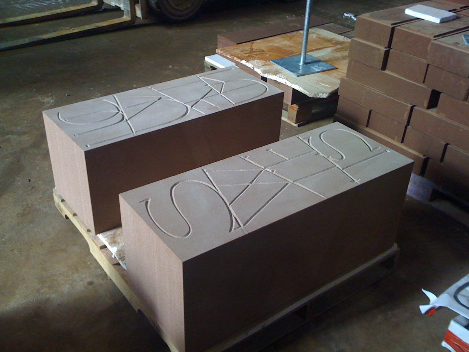
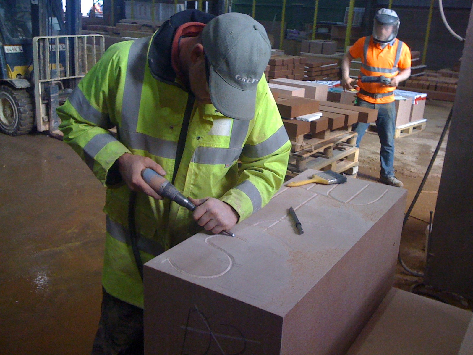
The posts and beacons include a section of carved stone elevated to the top of the timber, alluding to a ‘precious’ artefact on display. The carved stone incorporates designs taken from Roman artefacts in Tullie House, providing a detailed feature.

WAYMARKERS
The way markers are used to define the route of the Hadrian’s Wall Path through Bitts Park, between Sheepmount and Swifts. The way markers are located at approximately 100m intervals and provide simple signage to users. The way markers are constructed from a solid piece of sandstone and are 900mm high (800mm above ground) x 200mm square with a slanted top. The design includes carved ‘Lvgvvalivm’ text and carved patterns of Roman artefacts that wrap around the stone. The slanted top and front of the markers includes 5mm rebates to incorporate vitreous enamel plates of the Hadrian’s Wall Country, National Trail and National Cycle Network No. 72 (known as Hadrian’s Cycleway) logos.
INFORMATION BOARD
The design of the information boards incorporates a carved supporting timber post used in the design of the beacons with a large curved double sided vitreous enamel panel with contextual orientation information on one side and historical information on the other. The contextual orientation information panels include a location plan and information identifying key attractions and routes within Carlisle, including the route of the Hadrian’s Wall Path and the location of the City Centre, the Historic Quarter and its attractions including Tullie House, the Sands Centre and Sheepmount. The historic information panels include text, images and plans interpreting Roman history in Carlisle and the history of Bitts Park. Including information about Stanwix Roman Fort, Carlisle Roman Fort and the location where Hadrian’s Wall crossed the River Eden.